
We offer customized studies that transform information into concrete results. Data are key allies for entrepreneurship, growth, and intelligent planning.
1. Geomarketing Study with location intelligence.
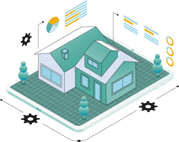
2. Real Estate Intelligence Study.
3. SmartLocal Study — mini urban study for SMEs.
4. Potential Ground Study — sectors under construction development.
5. BuildAhead Study — early opportunities in construction.
6. Risk Study — risk-sensitive territorial planning.
7. Urban Tree Coverage Studies.

Our studies:
¡Toma desiciones y potencia tu proyecto o negocio con data urbana!
Geomarketing
Geomarketing combines economic and demographic data with geolocation tools to help you better understand the territory, your competitors, and your potential customers.
Through GeoCIIU, we provide key information to design more effective market strategies with greater returns. Visualize your competitive environment, identify high-potential zones, and tailor your products to the real needs of the market.


1.
With location intelligence
Make strategic decisions with location intelligence

Why use Geomarketing?
Identify the most profitable or strategic zones for locating projects or points of sale.


Analyze who buys, where they live, and what drives their decision, through demand segmentation and characterization.

Evaluate the competitive landscape of a product or brand through competition and positioning studies.

Optimize resources and reduce operating costs.

Increase return on investment with decisions based on georeferenced data.

Focus your commercial efforts on specific, high-interest niches.


2.
Real Estate Intelligence Study
With this study, your real estate project does not just adapt to the market — it anticipates and transforms it.
Geomarketing combines economic and demographic data with geolocation tools to help you better understand the territory, your competitors, and your potential customers.
Through GeoCIIU, we provide key information to design more effective market strategies with greater returns. Visualize your competitive environment, identify high-potential zones, and tailor your products to the real needs of the market.
What do we achieve with this study?
- Design real estate products that respond to the real needs of people.
- Enhance property absorption and value.
- Improve profitability and brand recognition.
- Generate positive impacts on the city and the community.

Our methodology integrates:
- Urban context analysis: mobility, safety, green areas, land use, buildability, geolocated socioeconomic profiles, niches, commercial prices and highest-demand typologies, land value, and competition.
- Geolocated analysis of residential or commercial vacancy.
- Competition study by typology and pricing.
- Geodemographic segmentation by customer profile.
- Pedestrian and vehicular uses and flows: sector dynamics and behaviors for the identification of high-footfall zones.
- Hedonic pricing models per m².
- Absorption or sales velocity forecasting.
3.
SmartLocal
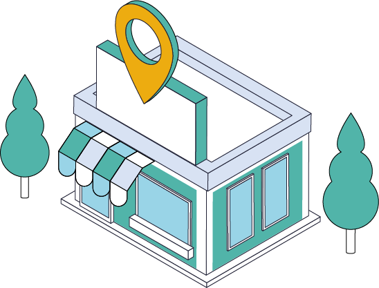
A practical and accessible analysis, designed for both SMEs and entrepreneurs, as well as investors.
Local-scale market profile
An accessible package that will help you better understand your neighborhood, its surroundings, and its market. With SmartLocal you will obtain clear data that will allow you to identify opportunities, anticipate risks, and make informed decisions about the location and growth of your business.

What do you get?
- Foot traffic passing in front of your business.
- Vehicle flow in the area.
- Identification of competing businesses.
- Presence of nearby facilities and services.
- Mobility and transportation: stops, lines, and accessibility.
Why choose it?
- Concrete and actionable: no unnecessary technical jargon.
- Fast and accessible: a cost-benefit approach for small businesses.
- Decision-oriented: every map and data point answers the question "what do I do next?"
4.
Potential Ground
Sectors under construction development
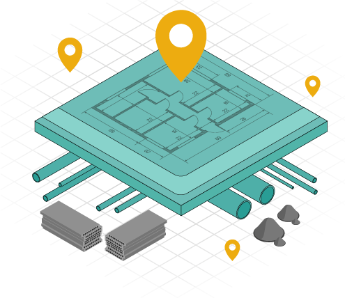
Potential Ground is a market intelligence solution developed by CIIU that integrates geolocation and aggregated reports to provide information on areas with potential construction activity, with data available at the national level.
With Potential Ground, identify projects before they break ground by detecting construction permits in process, urban planning studies, or land movement activity.
Service features
• Active concentration maps
Clear and intuitive visualizations identifying zones with ongoing construction processes, represented at the level of specific plots
• Strategic geographic prioritization
Classification of zones by activity level (high, medium, or low), enabling your organization to optimize resources and focus efforts on areas with the highest demand potential.

• Anticipated temporal trends
Periodic contracting of this service activates the Timeline tool on the CIIU geoportal, which shows when a zone first began construction activity.
This feature is ideal for planning staff deployment and anticipating market dynamics.
Benefits
This service will allow you to focus commercial efforts, anticipate demand, and strengthen your position as a strategic partner in the construction sector.
5.
BuildAhead
Early-stage opportunities in construction
BuilAhead is a market intelligence solution developed by CIIU that identifies projects expected to be built in the city of Quito, even before construction begins.
This makes BuilAhead a key tool for suppliers and stakeholders in the construction sector, providing early access to strategic information on new market opportunities and potential sales for their products or services.

Benefits.
BuildAhead enables companies supplying products and services related to the construction market to anticipate market opportunities through the following benefits:
1. Early access to information
2. Georeferenced market intelligence
3. Competitive advantage for suppliers
4. Sector analysis and market forecasting
5. Integration with other CIIU solutions

6.
Risk Assessment
Risk-sensitive land-use planning
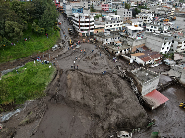
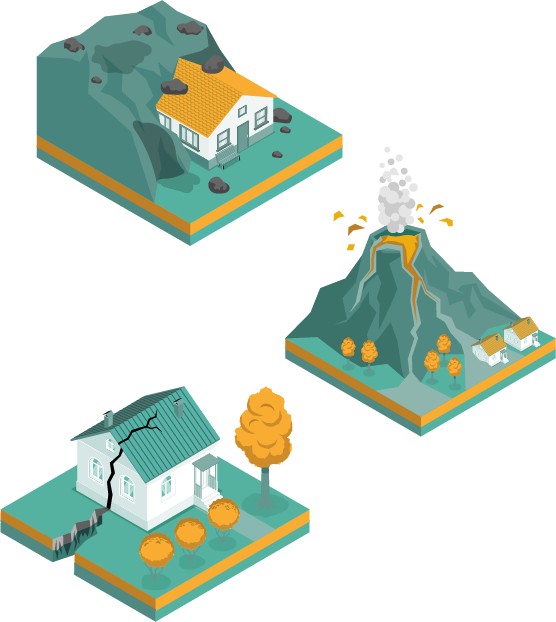
Aware that Ecuador is a multi-hazard country—exposed to earthquakes, volcanic eruptions, floods, landslides, wildfires, among other threats—we make our expertise available to local governments to develop risk assessments integrated into territorial planning and land-use management instruments, with a focus on prevention, risk reduction, response, and recovery.
Which planning areas do we contribute to?
- Partial Plans
- Complementary Plans
- Territorial Development and Land Use Plans (PDOT)
- Land Use and Management Plans (PUGS)
What is the scope of our studies?
Depending on the scale (national, cantonal, parish, or project level), the study may include:
- National / regional scale: multi-hazard risk mapping, public policy guidelines, and identification of strategic protection areas.
- Cantonal scale (Partial Plans, Complementary Plans, PDOT, PUGS): delineation of risk areas, land-use zoning, and safe growth scenarios.
- Parish or sectoral scale: hazard microzonation, community-based risk management plans, and local capacity building.
- Urban development / real estate project scale: geotechnical studies, analysis of site-specific hazards, and mitigation and contingency measures.
A safe territory is also a territory with a future.
Let’s connect and build solutions together that reduce risks and create opportunities.


7.
Urban Tree Studies
With our studies, urban trees become more than just an inventory—they become a strategic tool for improving quality of life in the city.
At the Quito Center for Urban Research and Information (CIIU), we have extensive experience in urban trees and urban heat islands, and we offer specialized studies on these topics to local governments (GADs), addressing two key scales:
1. Urban tree, gaps, and shade detection study
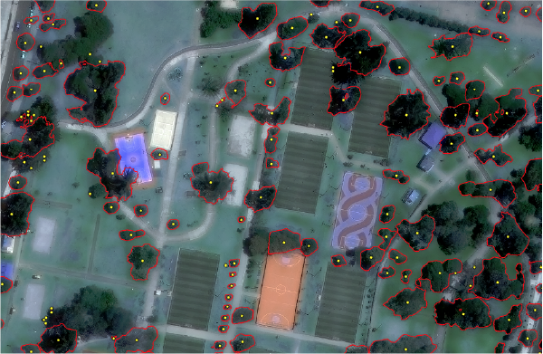
Using advanced technologies such as SAM and tree canopy cover analysis (ICC) across the urban footprint, we generate a Tree Deficit Index that measures tree coverage within city blocks and road corridors. In addition, we identify tree canopy widths to locate areas with insufficient shade coverage. Finally, we complement these studies with an environmental analysis of Urban Heat Islands and pollutants such as CO₂, SO₂, and CO, helping prioritize the areas where urban trees can contribute most effectively to reducing surface temperatures and improving air quality.
Service benefits:
- Provides a fast and cost-effective first approach to urban tree planning, without the need for exhaustive inventories.
- Identifies urban tree coverage and gaps based on spatial indices.
- Locates critical areas with insufficient urban shade, helping target greening interventions where they are most needed.
- Enables the integration of environmental criteria such as surface temperatures and air pollutants to prioritize areas for tree planting.
- Supports the early incorporation of interventions into mobility, public space, and land-use planning strategies.
2. Urban Tree Census, Monitoring, and Management Study
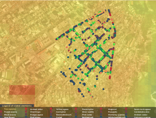
At CIIU, we were pioneers in Ecuador in the development of technical studies on urban trees. Since 2019, through the experience of Quito’s Tree Plan, we have established ourselves as the first center in the country to apply comprehensive methodologies for the survey, assessment, and management of urban trees in public spaces, using advanced technology
Service features
- Urban tree censuses with precise georeferencing and real-time data validation.
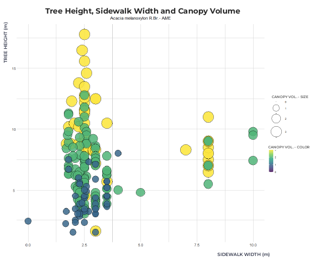
- Structural and phytosanitary assessments using international methodologies (VTA), enabling the identification of aspects such as biodiversity and ecological functionality, physiognomic and structural characterization (condition, form, height, canopy cover, etc.), adaptability, and interactions between urban trees and infrastructure.
- Data science and AI-driven analysis to calculate biodiversity indices, canopy cover, priority intervention and monitoring areas, urban green network assessments, and tree gap detection.
- Identification of critical areas with insufficient urban shade to target greening interventions where they are most needed.
Prioritization of tree species supported by updated pollution maps (NO₂, SO₂, CO), urban heat island mapping, and consideration of urban ecosystems.
- Tree management plans with an ecological and urban approach, integrating current regulations, risk control, and reforestation strategies.
- Knowledge transfer to municipal technical teams, ensuring long-term sustainability and autonomy in urban tree management.
Development of geoportals and dashboard systems compatible with GIS platforms for the analysis and management of collected data.

Why choose us?
- Proven experience: the first center in Ecuador to carry out this type of study (since 2019).
- State-of-the-art technology: we combine satellite imagery, artificial intelligence, and data science.
- Integrated approach: we bring together urban planning, environmental management, and citizen participation.
- Real impact: our studies provide the foundation for public policy, sustainable mobility projects, and climate resilience strategies.


Cobertura de copa
Arbolado urbano e islas de calor
Mapa de contaminantes - SO2
Relación entre altura del árbol, ancho de vereda y volumen de dosel
Contact
General Inquiries
Documentation
User Support
Sponsored by:
Follow us on social media



Nuñez de Vela N35-204 e Ignacio San María
CP: S170515
Quito - Ecuador
Políticas de privacidad
All rights reserved








Urban Research and Information Center (CIIU)
Architects’ Association of Ecuador – Pichincha Province (CAE-P)