
Safe Zones – Alausí
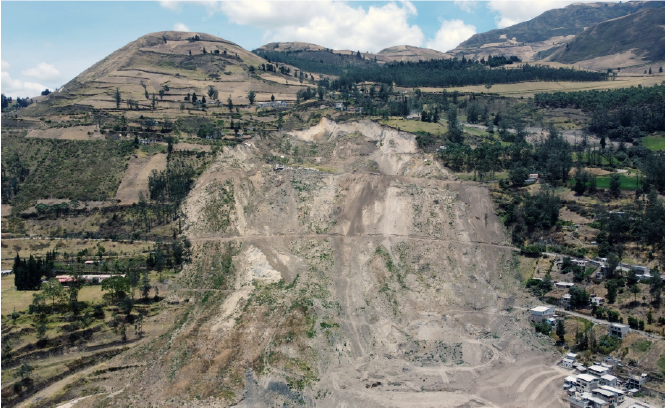
This study was carried out within the framework of the project “Technical Assistance for the Analysis of Vulnerabilities and Natural Hazards Affecting Human Settlements, and the Development of Guidelines and a Master Plan for the Identification of Safe Areas for the Implementation of Housing Projects Consisting of at Least 163 Housing Units in the Canton of Alausí, Chimborazo Province,” commissioned by MIDUVI.
The study was developed in several phases. The first phase consisted of an exposure assessment focused on human settlements, evaluating geological and hydrometeorological hazards.
The second phase involved the identification of safe land areas suitable for the implementation or relocation of housing projects comprising at least 163 housing units. This was achieved through a multicriteria spatial analysis designed to support decision-making regarding potential relocation sites. The methodology employed the Analytic Hierarchy Process (AHP), considering nine factors selected based on their relevance to housing planning and the availability of reliable data.
The third phase focused on identifying and selecting the optimal site. This process initially evaluated the risk and vulnerability conditions identified in the previous phase and subsequently assessed the economic feasibility of the proposed locations.
In the fourth phase, an architectural master plan was developed for the selected site, covering an area of approximately 2.1 hectares.


If you have a research project that you would like to showcase on our geoportal, or if you would like to collaborate in the development of a new one, contact us!


Contact
General Inquiries
Documentation
User Support
Sponsored by:
Follow us on social media



Nuñez de Vela N35-204 e Ignacio San María
CP: S170515
Quito - Ecuador
Políticas de privacidad
All rights reserved








Urban Research and Information Center (CIIU)
Architects’ Association of Ecuador – Pichincha Province (CAE-P)