GeoCIIU
A geospatial viewer
With georeferenced data sourced from public datasets, in-house research, and contributions from our network of collaborators.
An intuitive and user-friendly geoportal that allows you to combine data by custom areas or zones, perform advanced queries, and generate your own indicators based on your specific needs.
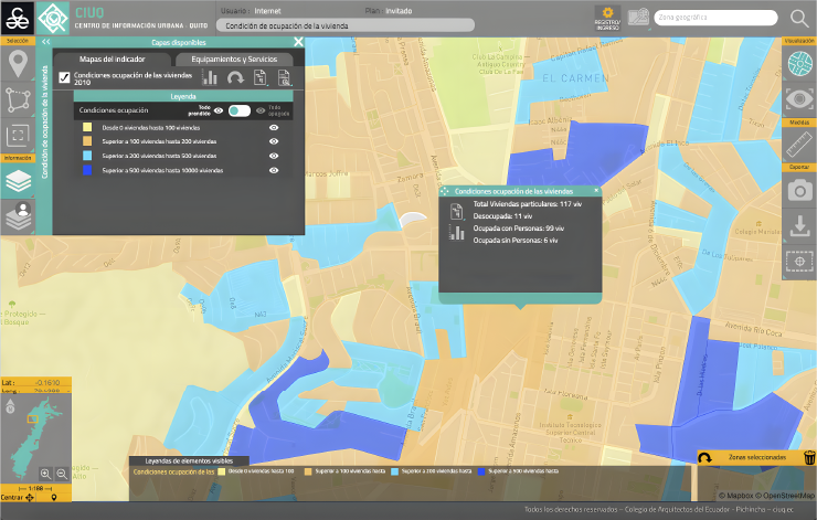


GeoCIIU is free to use—you only need to register to access the unlimited version of its tools.
Registration is completely free.
Learn how to use GeoCIIU tools
Watch our tutorials
Tutorial 1

Selection tools
Learn how to select areas such as parishes, neighborhoods, or create custom zones.
Tutorial 2
Visualization and measurement tools
Learn about the different visualization types and the measurement tools available.
Tutorial 3
Indicator selection tools: Grouping
Learn how to select indicators and explore the different ways they are visualized within the geoportal.
Tutorial 4
How to perform advanced queries
Example case: Which areas are safe in the event of an eruption of Cotopaxi Volcano?
Learn how to perform advanced queries and access more specific information within the geoportal.
Tutorial 5
How to perform advanced queries (Part 2)
Example case: Where could I locate a nightclub near Avenida América and Bogotá Street?
Learn how to perform advanced queries and access more specific information within the geoportal.
Tutorial 6
Downloading files and shapefiles
Learn how to download files, images, and shapefiles.
Follow us on social media and stay up to date with the latest GeoCIIU updates.



Contact
General Inquiries
Documentation
User Support
Sponsored by:
Follow us on social media



Nuñez de Vela N35-204 e Ignacio San María
CP: S170515
Quito - Ecuador
Políticas de privacidad
All rights reserved








Urban Research and Information Center (CIIU)
Architects’ Association of Ecuador – Pichincha Province (CAE-P)