
Determinants of the Urban Heat Island Effect in the Quito Metropolitan District (DMQ)
This research aims to analyze the presence of urban heat islands in Quito’s central plateau and their relationship with the expansion of the urban footprint since 2010. The Urban Heat Islands Study was developed and coordinated by the Center for Urban Research and Information (CIIU), with the valuable collaboration of leading researchers in the field.
Phase 1
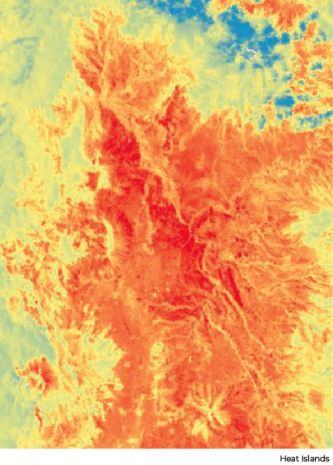
The first phase consisted of a multitemporal analysis to determine the presence of urban heat islands and the expansion of the urban footprint for the years 2010, 2015, and 2020 using remote sensing techniques. It also examined the relationship between temperature increases, urban expansion, and land-use changes during the 2010–2020 period.
Phase 2
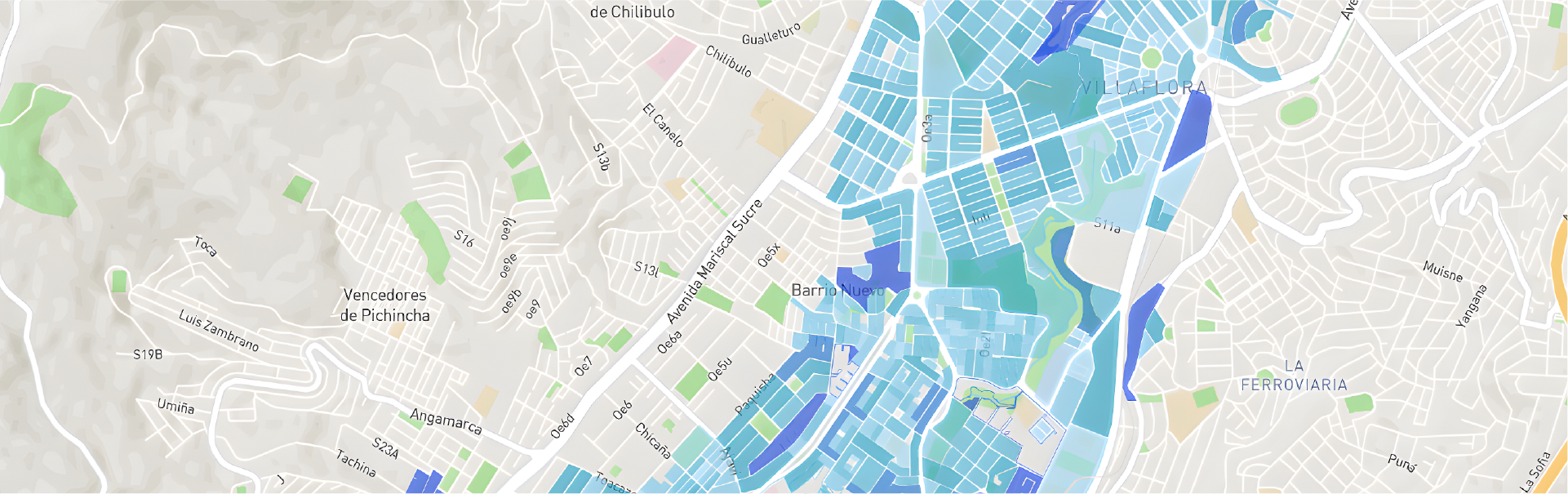
The second phase focused on identifying and selecting survey segments for in-situ thermal measurements, conducting daytime thermal measurements at a height of 1.5 meters above ground level, and comparing temperatures between areas with higher and lower tree densities per square meter.
Phase 3
The final phase of the research involved the Local Climate Zone (LCZ) classification of the 13 study areas, the assessment of urban geometry, and the calculation of the Sky View Factor, Aspect Ratio, building area, permeable and impermeable surface areas, roughness height of urban elements, and land-cover classification for each study area.
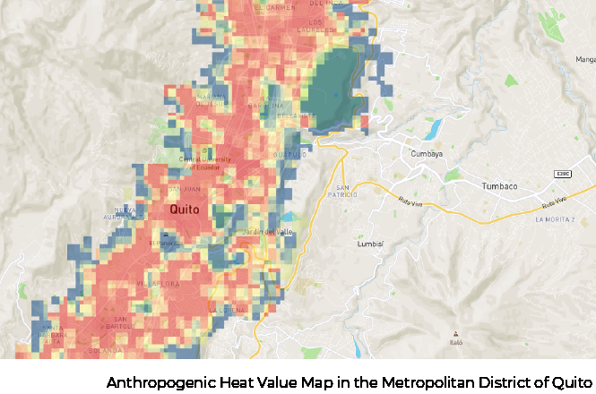
In addition, thermal properties were evaluated, including surface albedo (shortwave radiation reflectance) and anthropogenic heat contributions.


If you have a research project that you would like to feature on our geoportal, or if you would like to collaborate in developing a new one, contact us!


Guest Researchers.
Paola Maigua López
Researcher
Ph.D. in Architecture and Urbanism, Technology, Environment, and Sustainability from the University of Brasília, and Master’s Degree in City Governance with a specialization in Urban Centrality and Historic Areas from FLACSO Ecuador.
She has participated in the development of Territorial Development and Land Use Plans (PDOTs). She served as Coordinator at MIDUVI for the Integrated Territorial Intervention Program (PITI) in San Lorenzo (Esmeraldas), Nuevo Rocafuerte (Orellana), and Puerto López (Manabí), and as Regional Director of Studies for Zone 9 at the Public Works Contracting Service (SECOB).
She is a member of LASUS (Laboratory for Sustainability Applied to Architecture and Urbanism) at the University of Brasília.
Her expertise includes bioclimatic design applied to architecture and urbanism, eco-efficient buildings, and simulation models for thermal, visual, and acoustic comfort.
She is currently involved in the following research projects:
“Local Climate Zone Atlas of Ecuadorian Cities”
“Crime in Large Buildings: The Satellite City of Águas Claras, Brasília”
“Evapotranspiration (ET) in the Formation of Urban Heat Islands (UHI) in Brasília”
“The Effects of Urban Trees and Vegetation on the Urban Climate of the City of Quito”

Diana Orellana Valdéz
Researcher
Architect and Master’s Degree holder in Urban Planning from the Polytechnic University of Catalonia. She is currently pursuing a Master’s Degree in Socio-Environmental Studies at FLACSO Ecuador. She is a university lecturer in the Faculty of Architecture at the University of Cuenca and at Indoamérica Technological University, and hosts the radio program Diary of a Pedestrian on FLACSO Radio.
Some of her research projects include the Sustainable Housing Construction Certification Method for Cuenca and The Evolution of Green Infrastructure in Four Case Studies: Maryland, London, Bologna, and Barcelona.
Her publications include:
Sustainable and Safe Building Certification (2018)
The Influence of Urban Tree Vegetation in Reducing Pollution Levels and Achieving Climate Comfort
An Approach to Characterizing the Urban Heat Island in Cuenca, Ecuador
Sustainable Urbanism and Evaluation Methods
Changes in the Valuation of Nature in the Barcelona Metropolitan Region
She is currently conducting research on the influence of green infrastructure in mitigating the urban heat island effect in Quito.
CIIU Women Collaborators
PAULINA CUBILLO BETANCOURT
Project Coordinator and Co-author
Geographic and Environmental Engineer, graduated from ESPE in 2005. She holds a Master’s Degree in Environmental Management Systems (2008) from SEK International University; completed graduate studies in Geographic Information Systems Development at the University of Seville, Spain (2012); earned a Master’s Degree in Territorial Planning (Cum Laude) from the University of Tor Vergata in Rome, Italy (2015); and obtained a specialization in Data Science in Costa Rica (2020).
She currently serves as General Coordinator of CIUQ.
KATHERINE VALVERDE TAPIA
Intern
Geographic and Environmental Engineer, graduated from ESPE in 2022. She collaborated as the coordinator of the ESPE student team for this project while completing her pre-professional internship.
Contact
General Inquiries
Documentation
User Support
Sponsored by:
Follow us on social media



Nuñez de Vela N35-204 e Ignacio San María
CP: S170515
Quito - Ecuador
Políticas de privacidad
All rights reserved








Urban Research and Information Center (CIIU)
Architects’ Association of Ecuador – Pichincha Province (CAE-P)